|
Forest Hall Sat. 8th July, 2000 |
|
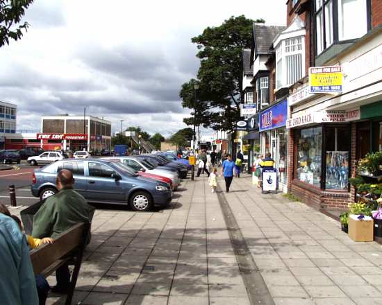
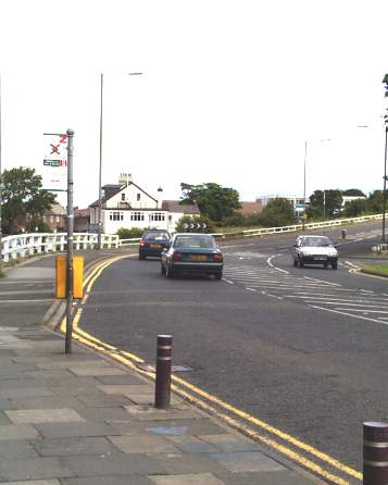
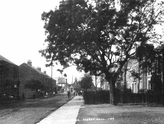
Forest Hall, called after a long gone palatial residence, is a north eastern suburb of Newcastle, adjacent to but fiercely separate from Killingworth. Until the mid 1960s it was a sleepy village with a railway station on the main line to Edinburgh.The view below, taken in 1910, shows the same scene as the picture above taken
today. You can see the railway signal box on stilts in the centre of the photo. There was a level crossing there, but now, at the site of the footbridge in today's picture, the main road is sliced in half. There is no
station today. |
 |
|
|
 |
 |
|
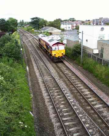
Here a loose EWS (England Wales and Scottish) freight loco uses the headway between express passenger
trains to reposition towards Newcastle. It had probably hauled a line of coal or ore waggons to the Alcan smelting works at Lyemouth, beyond Ashington to the North.This marks the position of the old
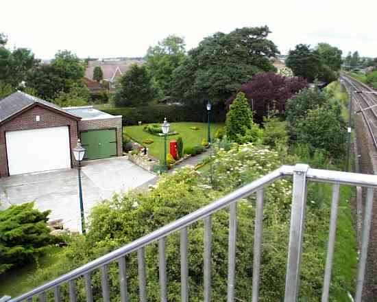
station at Forest Hall. The picture below is from the footbridge and shows the site of the station platforms and buildings, now a private house and grounds. The owner clearly tries to keep the memory alive
by preserving some old post boxes and lamp posts along his driveway. |
|
 |
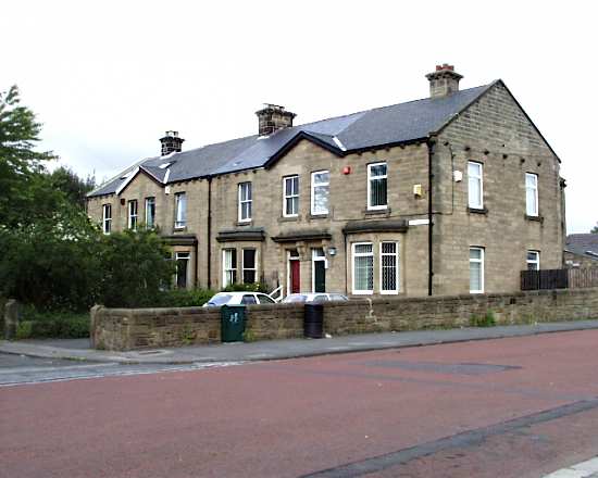
A little distance from the old station, heading south these 19th century houses stand defiantly against more recent development around
them. This is Benton View. |
 |
|
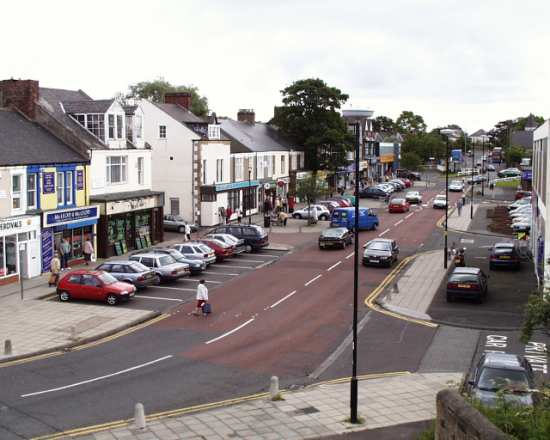
Looking towards the last view, from the south along the main road from Benton Four Lane Ends and Newcastle is Station Road. The new road curves to the right over the railway, the old road went straight through those white railings towards the level crossing. Behind the second lamp post
from the left you can see the top of the shops in Station Road North. The white building is a school for little ones, converted from a Miners' Welfare Centre. |
|
|
|
 |
|
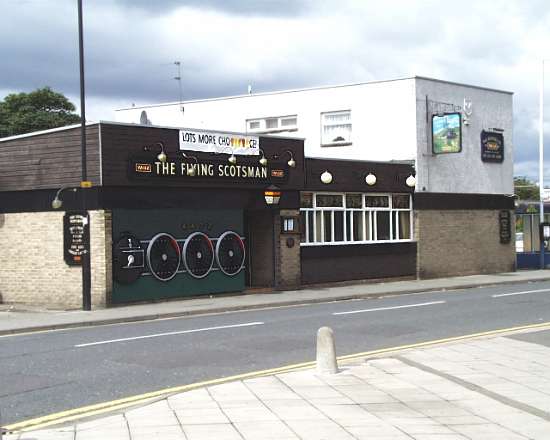
Here is Station Road North from the footbridge. The junction with the new road can be seen at the far end.Below is the Flying Scotsman pub, again suggesting the past, but catering for today. The glasses of Broon Ale and Exhibition rattle every 20 minutes or so as a couple of thousand tons of train hurtles past at 100
mph (160 Kph) only a few metres away. |
|
 |
 |
 |
 |
 |
|
 |
|
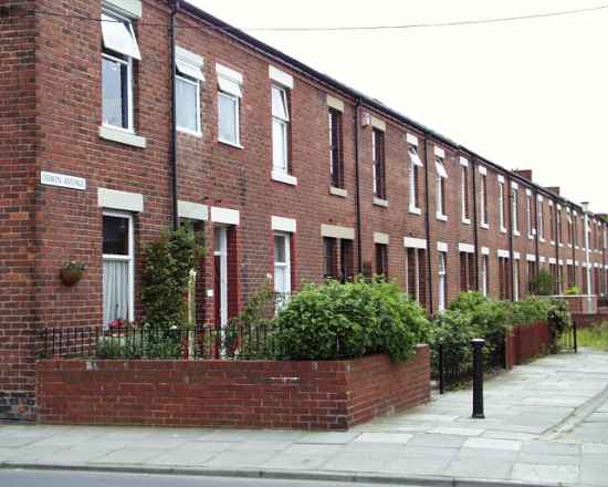
A few streets away some of the original terraces still exist, much modernised and mercifully Traffic free. These back onto Forest Hall
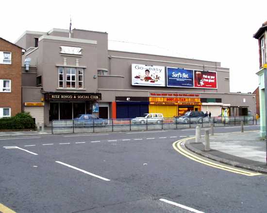
Road on its way to Clousden Hill in the north. This is Oswin Avenue.This is the Ritz, Forest Hall Road, for many years the focus of local night life, firstly as a cinema, and now a bingo hall. Note
that the seats inside run at right angles to the road, the screen end being to the right. This unusual arrangement was adopted to save the housing behind when it was constructed during the 1920s. |
|
|
 |
|
 |
|
|
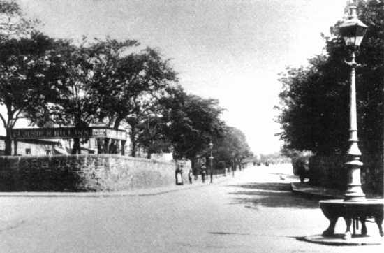
This 1900 view is of Clousden, the junction of forest Hall Road to the right with Great Lime Road, straight on and behind. Great Lime Road follows an ancient track and was so called from the progress of ore to the nearby lime kilns.
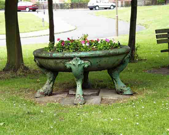
At the base of that old lamp standard is a circular horse trough. This object found its way to the North Tyneside Council depot scrap heap where it languished for over half a century. During 1974 local historian and
photographer Jack Phillips persuaded the council to restore it almost to its original position; this time as a floral planter! |
|
|
 |
|
|
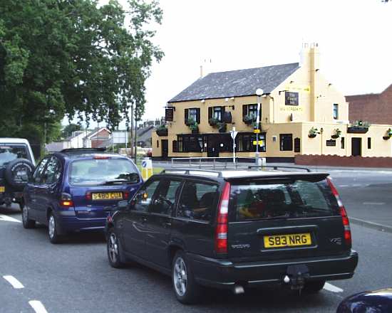
Finally, the Clousden Hill Inn in that old photograph still exists, but today as the Coach Inn. Here is the view
of that junction looking north from Forest Hall Road, Great Lime Road runs from left to right at the junction. |
|
|
 |
|
 |
|
|
 |
|
If you should arrive here via a search, or be missing the navigation on the left hand side, click this button.
|
|

