|
Byker
Sat. 15th July, 2000 |
 |
|
|
This eastern part of the city has undergone constant change since its first flourish in 1865. The name is from "by kiarr",
meaning near a marsh.Thousands of flats and small houses were built in terraces stretching south from the site of the present shopping street, Shields Road, and the riverside route,
Walker Road. |
|
|
 |
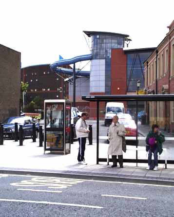
Part of the new swimming pool currently under construction. |
|
|
 |
 |
|
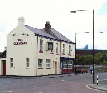
The original focus of Byker was here at Byker Square. The Glendale is all that remains of the
original here. In the distance you can see the "Byker Wall" with its colourful spiky vents. This 1970s housing development was part of the Tom Dan Smith grand plan. Between the wall
and the pub runs the new Metro rail line and a new trunk road (planned to be a motorway, but only half built). The people in the picture head for the underpass. That road and rail line have sliced this
district in two. |
|
|
|
 |
 |
 |
 |
|
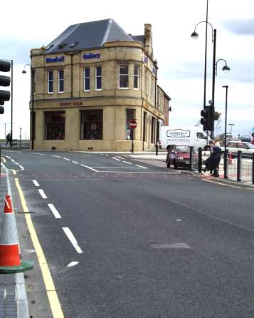
Nearby, today's home for the Hardisty Cycle showroom and workshops is called Bluebell Gallery.This
building dates from 1765, and those circular corners once sprouted conical turrets. It remained the Blue Bell public house for two hundred years until the modernisers took over and
reinvented it as The Charles Dickens. It promptly went bust and the building was left empty and derelict until the present incumbents moved in during 1993 following restoration by the local Counci paid for
out of the Heritage budget. |
|
|
|
This view from Shields Road, now bypassed by the new road beyond, shows the edge of a late 19th century terrace on the right,
the 1970s Byker Wall in the distance, and the new Municipal Swimming Pool and Library, still under construction, sandwiched between.The new Library is a subject of contention, as
residents of adjacent Heaton want their branch library, now a listed building, to be kept open. This will almost certainly not be so. So the new library and swimming pool construction continues apace. Soon
we will be able to visit the bookshelves lined with such titles as "The Water Babies", "The Cruel Sea", and "Moby Dick". |
|
 |
 |
|
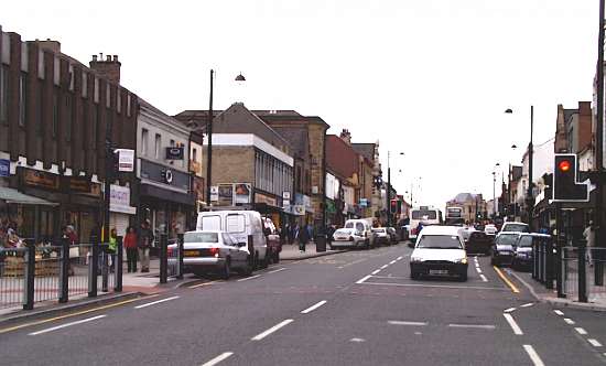
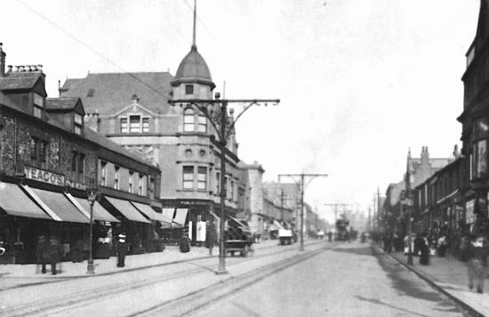
This view looks east up the slight incline of Shields Road, the main commercial centre of present day Byker. The
Blue Bell is visible at the far end. It is at this point that Shields Road and Fossway diverge. The latter follows the course of the Roman road to Segedunum, the fort at the beginning of Hadrian's wall at present day
Wallsend.Below is the same view as seen in 1910. The trams ran in the middle of the road. At stopping points a small flag would show to order all other traffic to stop, thus allowing the passengers safety whilst
boarding and alighting. |
 |
 |
 |
|
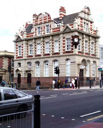
Part way along Shields Road is its junction with Heaton Road, a wide tree lined thoroughfare leading to the
once prosperous suburb. The housing in Heaton was more expensive and spacious when compared to the working class stock in Byker.Here on the corner is one of the original homes for the Trustee Savings
Bank, a sort of Co-operative venture to rival the money grabbing banks of the time. The TSB was run on altruistic lines to appeal to the new middle class and those of the working class who were rising in
fortunes. The TSB has since fallen prey to the robbers in striped pants and is now part of Lloyds. |
|
|
 |
 |
|
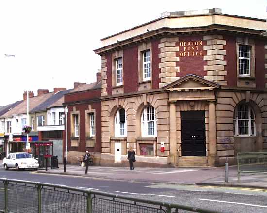
Here, next to the bank is the Post Office on Heaton Road. This has been vacated in the grand sell off which is
privatisation in all but name. The Post Office removed to a section of the nearby Safeway Supermarket, in an attempt to become cosy with big business. However it became the subject of a number of robberies and an
internal swindle involving the sale of supposedly "lost" benefit books. It is about to move to a small vacated bank building on the main road to improve security. |
|
 |
 |
|
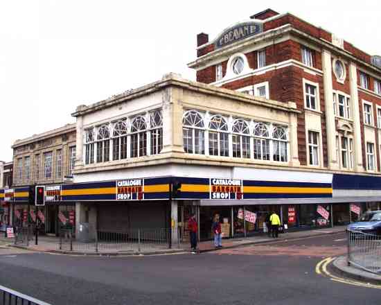
Beavan's department store was built during the latter part of the 19th century, and this picture shows the furniture department, opposite
the main shop. The front part of the building looks like an afterthought, but it was part of the original building. It was limited to two storeys as it was built over the underground section of the Riverside branch of
the London & North Eastern Railway. The line diverged at the end of the Ouseburn viaduct and dropped down to the river, whilst the main line carried on through Heaton Station, about 700 metres to the north
|
|
|
 |
 |
|
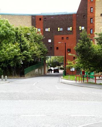
Here is a hole in the Byker Wall. This is Rabygate, the site of the original Raby Street, the main north
south through route linking Shields Road and Walker Road at the foot of the hill. This ran through the grid of terraced streets housing the workers for the ribbon of industry on the banks of the Tyne.The
thick walls and small windows are a soundproofing measure to avoid the anticipated disruption caused by the planned motorway. This has only recently been built, but only one carriageway was constructed and
is an urban route. |
|
 |
 |
 |
|
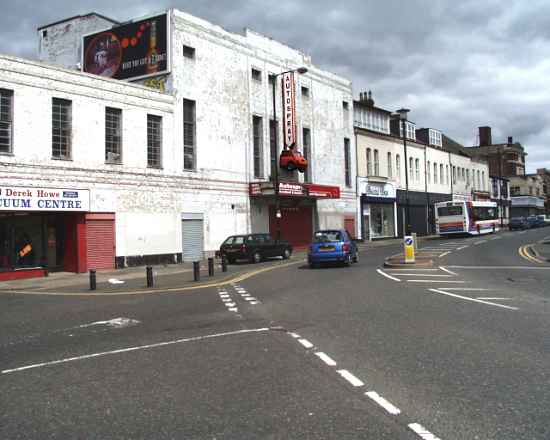
This section, at the western end of Shields Road from (but not including) Beavan's Store, seen on the extreme right to the junction of
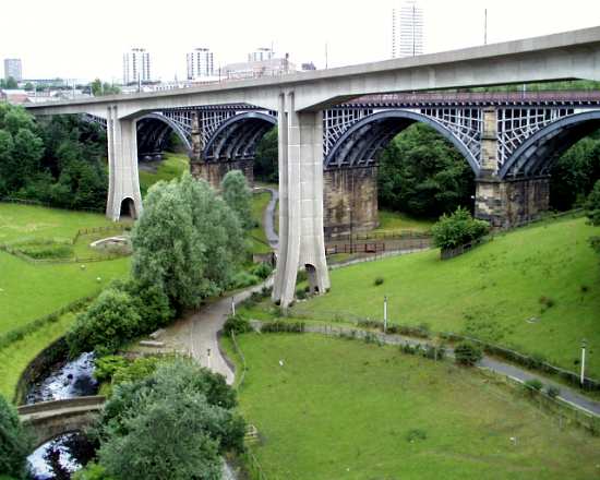
Wilfred Street, to the left of the Vacuum Centre, is to be demolished. A new shopping mall is to be built stretching from here to the railway line at the rear. The central building, now a vehicle paint shop, was the Apollo Cinema. Many local residents can trace their origins to the goings on in the back row here!Below is the view from the Byker Road Bridge over the Ouseburn valley.
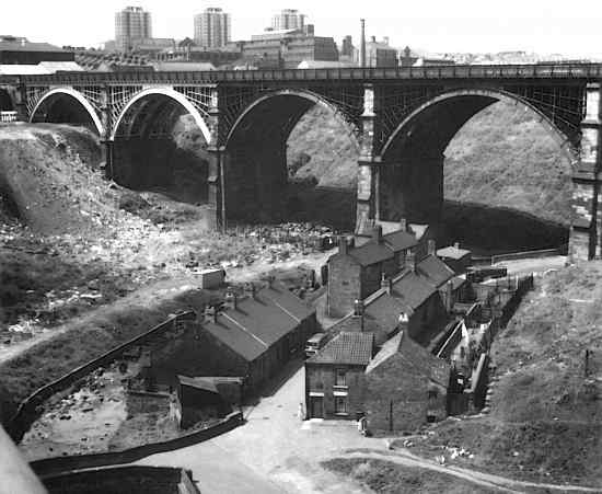
This river flows through the north of the city, is a prominent feature of the beautiful Jesmond Dene public park, donated by Lord Armstrong, and then along a covered culvert to emerge here on its course to join the
Tyne. The new Metro rail bridge and the older rail bridge span the steep valley. The lower picture, taken by Jack Phillips in 1961, shows the same scene with the then existing slum dwellings below. |
|
|
 |
 |
|
 |
|
|
 |
|
If you should arrive here via a search, or be missing the navigation on the left hand side, click this button.
|
|


